Home Officers Trails Upcoming Events Recent Events Links Join


Trails and Bridges
(Latest update October 22, 2021)
Herb Lindberg

The first trail of interest is by car, namely how do you get to Bridgeport?  This is shown in the Google map below, where Bridgeport is pointed out by an "A" in an orange "thumbtack."  A printable version is given in a pdf file for the same map.  The three most-used routes to Bridgeport are:

From Sacramento or Auburn:
Proceed northwest on Highway 80 until you arrive at Auburn.  Then exit onto Route 49 heading north (exit right then turn left at the stoplight to go under the freeway). Stay on 49 until Grass Valley where you exit onto Route 20 heading west (exit right then turn left at the stoplight to go over the freeway).  Continue west on 20 past the Rough and Ready stoplight at the bottom of a hill and then turn right at the next stoplight onto Pleasant Valley Road.  Continue north on Pleasant Valley Road about 8 miles until you arrive at the park at the South Yuba River.

From Grass Valley:
Head south on combined Route 49 and 20, turn right onto Route 20 and proceed westward.  Continue on to the park as in the route above.

From Nevada City:
You can use the same route as from Grass Valley by heading south on combined Route 49 and 20 until you turn right onto Route 20.  An alternate (northerly) route is to head west on Route 49, past the South Yuba River (down a winding road to the river and up a winding road on the other side) and then turn left onto Pleasant Valley Road at Peterson's corner.  Wind past rural homes and then down to the South Yuba River at Bridgeport.  You can't avoid a winding road down to Bridgeport on Pleasant Valley Road from either the south or the north, but the northerly route is more winding because you must go down to the river twice when coming via Route 49.  Furthermore, Peterson's Corner is not well marked except by a popular bar and restaurant at the corner.  The northerly route is used by north-of-town locals and visitors seeking a more interesting drive.

Roads leading to Bridgeport, on Pleasant Valley Road where it crosses the South Yuba River


The South Yuba River State Park encompasses 20 miles of river canyon, many more miles of trails, and four historical bridges.  Further information about these trails, bridges and swimming holes is available via links to other websites.  The Independence Trail is just down river from (west of) 49er crossing and so popular that a page is included here via the preceding link.  Two other trails so central to Bridgeport that links are given on the home page as well as here are Buttermilk Bend Trail and Point Defiance Trail, both beginning near the Visitors Center at Bridgeport as seen in the map below:

Trails emanating from Park Headquarters / Visitors Center at Bridgeport


The map above is derived from a photograph of the new trail display located between the headquarters parking lot and Wood's bridge.  Click on Bridgeport Trail Map for a printable version in pdf format.

A more comprehensive map, but still not the total 20-mile scope of the South Yuba River State Park and far less detailed than the above map, is given in another new map display which is in the northeast corner of the headquarters parking lot.  Below is a reduced version of the map:

Map of more (but still not all) of the 20-mile span of the South Yuba River State Park


This map is given here because it shows the locations of four historic bridges along the river, which are, from west to east (left to right): (1) Bridgeport, (2) Hwy 49 Crossing, (3) Purdon Crossing, and (4) Edwards Crossing.  Below are photographs of the three beautiful bridges upriver from Bridgeport (historical notes are given at the bottom of this web page):

The old concrete arch bridge at 49er Crossing (1921)


Continuing up river is the elegant truss bridge at Purdon Crossing (1895).  The unique half trough design makes this the only bridge of its kind in California.  It is only one lane with a severe load limit because of deterioration, so County Supervisors are considering a replacement.  

Technical note:  Observe that the truss cross members tilt away from the center of the bridge, and hence are in tension.  They are therefore simple slender rods, which carry tension efficiently but would buckle under compression.  The truss vertical members are in compression and hence are flanged columns to keep them from buckling.  This design is called a Pratt Truss, after the man who first built a working bridge with this design.  It is more suitable for metal bridges than wood because the compression members are shorter than the tension members and have less susceptibility to buckling.  The reverse is true for the Howe Truss used in Wood's bridge at Bridgeport, in which the diagonals tilt toward the center of the bridge and are compression members, more suitable for wood construction, because at the lower strength of wood the cross section is larger than for wrought iron and resists buckling.  The vertical members of a Howe Truss are in tension, and hence are metal rods at Bridgeport.

Elegant truss bridge at Purdon Crossing (1895).


Still farther up river is this 114-foot arch-truss bridge at
Edward's Crossing (1904) on North Bloomfield Road


Several trails emanate from the area around Edward's Crossing, as seen in the above map.  The South Yuba Trail upriver from the bridge is on the north side of the river.  The downriver trail from Edwards Crossing to Purdon Crossing starts right at the bridge on the south side of the river.  There is limited parking off the road.

Edwards Crossing viewed from the trail to Purdon Crossing.


Early South Yuba River Crossings
A brief note in the Feb. 2007 SYRPA Newsletter

The discovery of gold at Sutter's Mill by James Marshall brought gold seekers to California, desperately searching all of the Sierra foothill tributaries and rivers.  In June of 1848, Jonas Spect discovered gold near a place called Rose's Bar.  Rose's Bar was a short distance downstream from present-day Bridgeport.  John Rose is given credit as the first European settler to build a permanent structure in Nevada County.  In 1848 he built a trading post for Native Americans and gold seekers that was halfway between present day Lake Wildwood and Bridgeport.

The gold seekers poured into Yuba River Canyon, concentrating heavily in the area of today's South Yuba River State Park. This was not only a migration of ethnic Europeans but one of ethnic Asians as well.  By 1852 there were 3,000 Chinese in what is now Nevada County, and 25,000 more throughout the other gold fields of the Sierra Nevada.  In fact, the Chinese made up 25% of the state's population by 1870.  (The 1852 census showed less than 950 native Americans). The rapid entrance of these emigrants in 1849 required them to set up tent sites along the sand bars of the South Yuba River. These sites where given colorful names such as Frenchman Bar, Banjo Bar, Illinois Bar, Jones Bar, and Champion Bar (near Hoyt's Crossing).

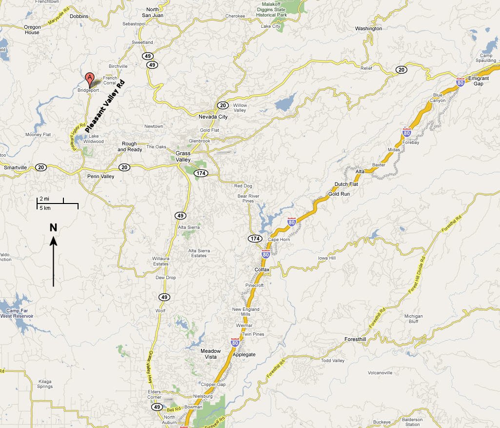
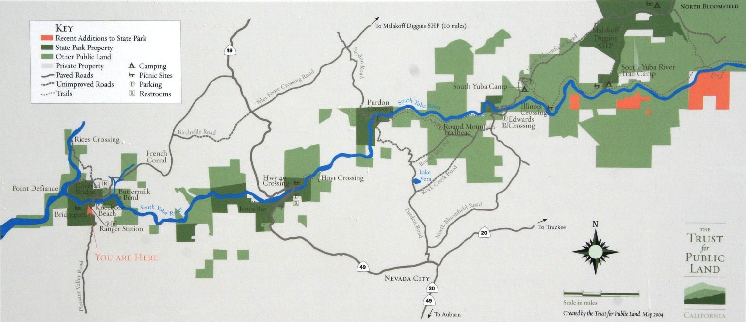
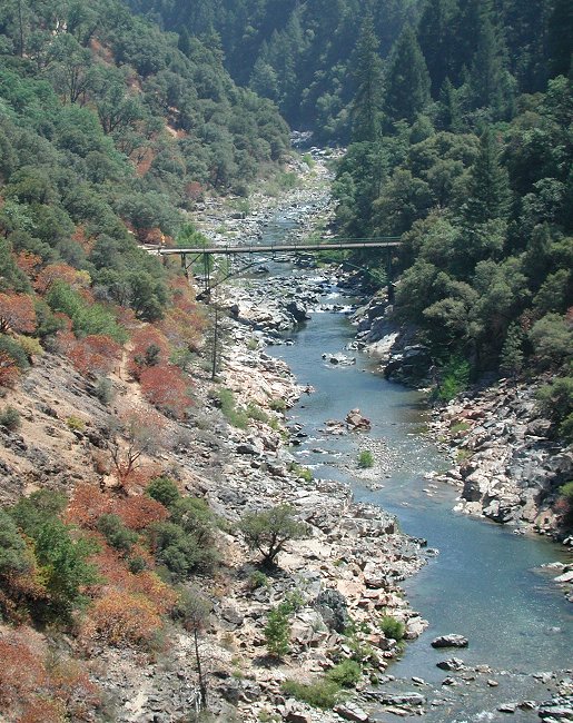
The need for crossings along the South Yuba River soon emerged.  First were the ferries: Point Defiance Ferry (near present day Bridgeport); Jones Bar Ferry (near present day Hwy. 49 Bridge); Moore's Ferry (present day Purdon Bridge); and Edward's Crossing near Illinois Bar. These crossings were little more than ferry owners overturning wagons and putting them together as makeshift barges.  Each crossing has its own unique history. Very quickly several ferry crossings gave way to construction of the first bridges.

The first bridges on the South Yuba River were at Bridgeport (Birdeye) in the early 1850's; Robinsons Lower Crossing (present day Purdon Crossing Bridge); Robinsons Upper Crossing (present day Edward's Bridge); Coopers Bridge (Illinois Bar); Hoyt's Crossing built by Moses Hoyt completed in 1854; and Coopers Bridge.

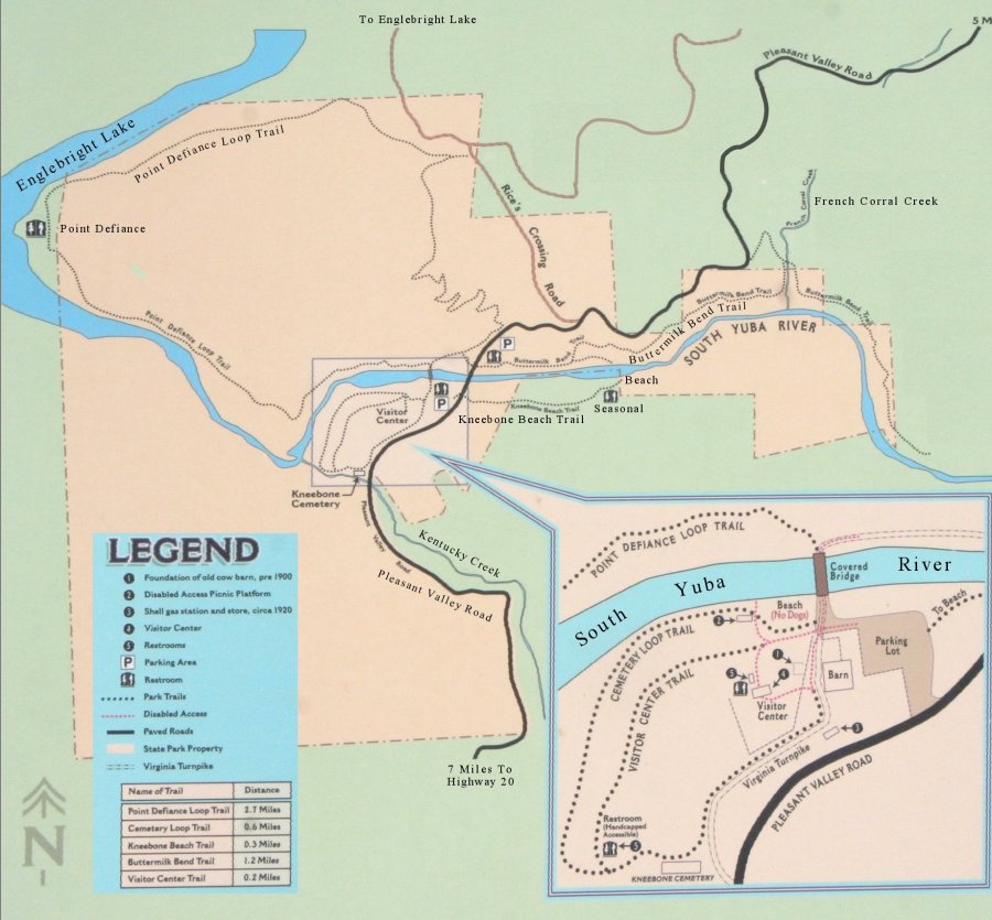
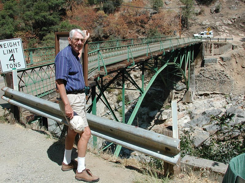
Lying within the South Yuba River State Park today are four historic bridges. The Bridgeport Covered Bridge, built in 1862, is a unique wooden structure incorporating both a Howe Truss and a Burr 
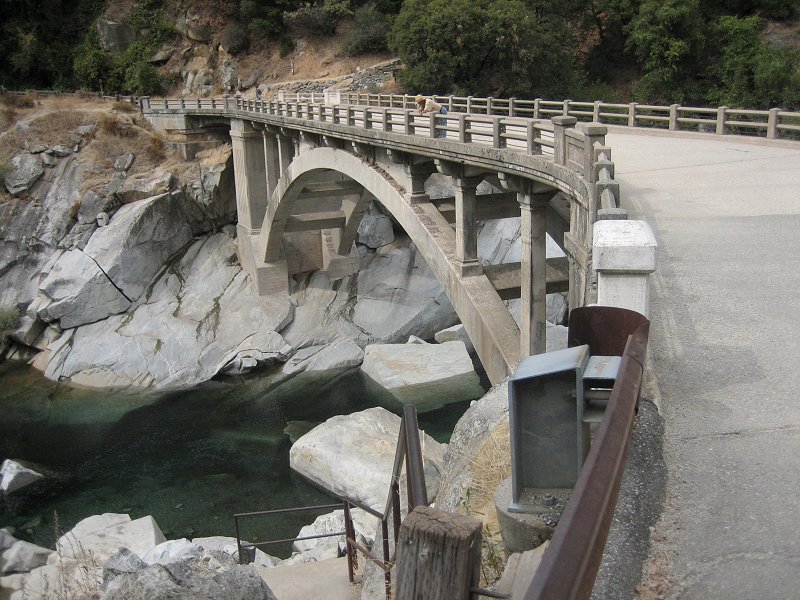
Arch. The Purdon Crossing Bridge, built in 1895, is the only remaining 
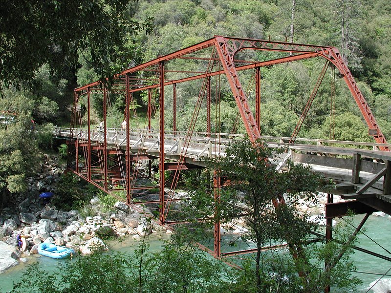
half-through metal truss system bridge west of the Rocky Mountains. The Edward's Crossing Bridge, built in 1904, is constructed with triangular members and steel pins in a three-hinged metal arch configuration. This bridge was the main access to North Bloomfield (Malakoff Diggings SHP.) from Nevada City using the old South Yuba Turnpike Road. The old Highway 49 Bridge, built in 1921, uses concrete for its arches and deck structure.


Home